
It is possible to date the start of the gradual emergence of modern cartography to the first decade of the fifteenth century when Jacopo d’Angelo produced the first Latin translation of Ptolemaeus’ Geographia(Geōgraphikḕ Hyphḗgēsis); this important Greek work had not been translated in the great wave of scientific translations in the High Middle Ages. This new knowledge of Ptolemaeus’ cartography with its projections and its longitude and latitude grids first took hold in Northern Italy, where its most famous early exponent was physician and mathematicus Paolo dal Pozzo Toscanelli (1379–1482) author of the so-called Columbus map.
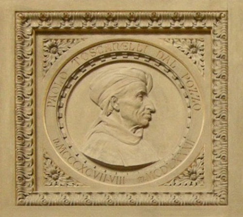
Paolo dal Pozzo Toscanelli Source: Wikimedia Commons
From Northern Italy the new cartographer spread fairly rapidly to Austria and by 1450 Vienna was a major centre for cartography. Not long after the invention of movable metal type printing editions of the Geographia began to appear, initially without maps but very soon with, and by 1500 various editions were making their way around Europe. From Vienna the knowledge of the new cartographer moved north into Germany, with two schools of cartography developing. The so-called historical school was centred on the St. Dié mapmakers in Lorraine and includes Sebastian Münster in Basel. Whereas the so-called mathematical school, also known as the Vienna-Nürnberg school, has Johannes Schöner and Peter Apian as its two most significant exponents. Both schools include both aspects of the Ptolemaic cartography, the historical and the mathematical, in their maps and the difference is rather more one of emphasis.
From Southern Germany the new cartography spread throughout Europe. Notable cartographers, for example, are Pedro Nunes in Portugal and Oronce Fine in France. However the major centre for the new cartography became the so-called Flemish school centred on Gemma Frisius at the University of Louvain. Its two most notable associates are Gerhard Mercator and Abraham Ortelius, the two most influential cartographers in the second half of the sixteenth century.
But what of England? As with the mathematical sciences in general, England lagged well behind the continent in terms of cartography. The first Britain to become acquainted with the new developments in cartography was probably John Dee, who following his graduation at Cambridge university travelled extensively on the continent and spent two years in Louvain studying and working together with both Gemma Frisius and Gerard Mercator.

John Dee artist unknown Source: Wikimedia Commons
During his travels he also formed close friendships with both Abraham Ortelius and Pedro Nunes. When he returned to Britain Dee brought the latest developments in the Ptolemaic cartography, Frisius’ new methods of surveying through triangulation and the latest astronomical, cartographical and surveying instruments with him from Louvain. The Flemish/Dutch influence is clearly visible in the early English atlases.
It is probably no coincidence that the two ministers at Elizabeth’s court in London who pushed hard for the introduction of the new cartography into England were Sir Francis Walsingham, principle secretary to Elizabeth, and William Cecil, 1stBaron Burghley, Elizabeth’s chief advisor, both of whom were Dee’s, somewhat unreliable, patrons at court.

Engraving of Queen Elizabeth I, William Cecil and Sir Francis Walsingham, by William Faithorne, 1655 Source: Wikimedia Commons
Their motivations for supporting the development of cartography were political and derived from military and commercial considerations and not academic or scientific ones. The same applies, of course to the general developments in cartography in the Early Modern Period throughout Europe. Burghley, the main driving force behind a new English cartography, possessed a self made atlas of manuscript maps from various sources that he is said to have always carried with him. Burghley’s atlas has survived and is now in the British Library.

William Cecil, 1st Baron Burghley from NPG artist unkown Source: Wikimedia Commons
Burghley saw the necessity, on political grounds, of organising and financing a new, modern map of the British Isles. The first cartographer, who appears to have received a commission to map Britain from Burghley, was John Rudd (c. 1498–1597). In 1561 Rudd, a graduate of Clare College and a fellow of St. John’s Cambridge, was granted a two-year paid leave of absence from his various positions in the Church of England in order to travel the country with the objective of mapping England. It is not know if Rudd fulfilled his objective, as no map of England can with certainty be assigned to him. However, it has been speculated that his work was a source for the new map of Britain published by Mercator in his atlas. Several of the maps in Burghley’s handmade atlas are attributed to Rudd.
![001ROY000018D03U00070000[SVC2]](https://thonyc.files.wordpress.com/2018/09/001roy000018d03u00070000svc2.jpg?w=500)
This is a manuscript map of County Durham. It forms part of an atlas that belonged to William Cecil Lord Burghley, Elizabeth I’s Secretary of State. Burghley used this atlas to illustrate domestic matters. The map dates from 1569 and is by John Rudd, the man to whom Christopher Saxton was an apprentice to in 1570. Source: British Library

Thomas Seckford Source: East Anglian Times
commissioned Christopher Saxton in 1573 to survey all the English counties and produce an atlas of the realm. It is not certain what motivated Burghley to act at this time but it might have been the publication of Ortelius’ Theatrum orbis terrarumin 1570, which was much admired in England, and/or Philipp Apian’s Bairischen Landtafeln from 1566
The survey of England began in 1574 and of Wales in 1577; it was completed in 1578. The individual maps were engraved as soon as finished and the proofs sent to Burghley.

Saxton England and Wales proof map Source: British Library
In 1579 the maps were bound together and publish as a book for which Saxton received ten-year exclusive publication rights from the crown.

Frontispiece Saxton The Counties of England and Wales Source: My facsimile copy
Although we now refer to Saxton’s book as an atlas at the time Mercator’s coining of the term still lay sixteen years in the future. It is not known how Saxton did his surveying work but the speed with which he completed the task and the general level of accuracy of his maps would suggest two things. Firstly that he had access to previous data, possibly from Rudd’s work amongst others, and secondly that he used triangulation in some form. The nationwide chain of beacons set up by the government to warn of a Spanish invasion from the Netherlands in 1567 would have provided him with a useful set of predetermined triangulation points. The pass issued by the Privey Council on 10 July 1576 for his survey of Wales also strongly suggests triangulation as his survey method.
An open Lettre to all Justices of peace mayours & others etc within the severall Shieres of Wales. That where the bearer hereof Christofer Saxton is appointed by her Maiestie vnder her signe and signet to set forth and describe Coates [Cartes] in particulerlie all the shieres in Wales. That the said Justices shalbe aiding and assisting vnto him to see him conducted vnto any towre Castle highe place or hill to view that country, and that he maybe accompanied with ij or iij honest men such as do best know the cuntrey for the best accomplishment of that service, and that at his departure from any towne or place that he hath taken the view of said towne do set forth a horseman that speak both welshe and englishe to safe conduct to the next market Towne, etc
“…any towre Castle highe place or hill to view that country…” strongly suggests triangulation.
There are 35 maps, each bearing the arms of the Queen and Thomas Seckford. Drawn by Saxton the maps were engraved by Augustine Ryther (5 maps) the only engraver who clearly identifies as English, Remigius Hogenberg (9 maps),Leonard Terwoort of Antwerp (5 maps), Cornelius Hogius (1 map), Johannes Rutlinger (1 map) all four of whom were Flemish, Francis Scatter (2 maps), Nicholas Reynold (1 maps) are both of uncertain origin. Of the remaining unsigned maps five are definitely engraved in the Flemish style. In general there are clearly Flemish elements in the style of all the maps.
It is not known for certain when John Dee and Christopher Saxton became acquainted and whether Dee had an influence on Saxton, but when Dee, as Warden of Christ’s College, Manchester (1595–1605), became involved in a boundary dispute he employed Saxton as his surveyor to settle the argument.
Although it sold well, Saxton’s atlas was not without its critics. Although some counties are presented on separate maps others are grouped together on one map. For example the 13 Welsh counties are presented on 7 maps or Kent, Sussex, Surry, Middlesex and London are all on one map. Because of the pages are uniform in size the map scales vary considerably. Also although the maps initially appear homogeneous the symbols used vary considerably from map to map, even between maps engraved by the same engraver. None of Saxton’s maps have roads. All of these imperfections led to various attempts to improve on Saxton’s work.
The first of these was John Norden (c. 1547–1625), who started a series of county histories, each accompanied by a map, entitled Speculum Britanniae.
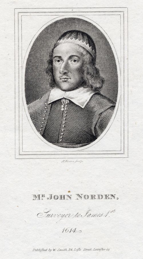
John Norden Source
The first volume Speculum Britanniae: the First Parte: an Historicall, & Chorographicall Discription of Middlesexwas published in 1593. The manuscript is in the British Library with corrections in Burghley’s handwriting, which points to Burghley being Norden’s sponsor. 1595 he wrote a manuscript “Chorographical Description” of Middlesex, Essex,Surry,Sussex,Hampshire, Wight, Guernsey andJersey, dedicated to Queen Elizabeth. In 1596 he published his Preparative to the Speculum Britanniae, dedicated to Burghley. The only other volume published by Norden was Speculi Britaniae Pars: the Description of Hartfordshirein 1598. He completed accounts of five other counties in manuscript of which three were published posthumously in 1720, 1728 and 1840. It was probably Burghley’s death in 1598 that put an end to Norden’s project.
![001ADD000033769U00003000[SVC2]](https://thonyc.files.wordpress.com/2018/09/001add000033769u00003000svc2.jpg?w=500)
John Norden’s map of Essex 1595 Source: British Library
![001HRL000006159U000040X0[SVC2]](https://thonyc.files.wordpress.com/2018/09/001hrl000006159u000040x0svc2.jpg?w=500)
William Smith map of Lancashire 1598 Source: British Library

John Speed Source: My facsimile copy
This activity attracted the attention of Sir Fulke Greville, 1stBaron Brooke (1554–1628) a leading Elizabethan statesman, who secured him a position at the Customs and with the support of the Queen, subsidized his map making.
Fulke Greville, 1st Baron Brooke Portrait by Edmund Lodge Source: Wikimedia Commons
A member of the society of Antiquities he became friends with such people as the historian William Camden (1551–1623) and the cartographer William Smith, who assisted him with his research. Speed published his atlas, The Theatre of the Empire of Great Britaine, which was dated 1611 in 1612. He regarded it as a supplement to his Historie of Great Britainepublished in 1611. The use of the word theatre in the title reflects the influence of Ortelius, whose own The Theatre of the World was published in English in 1606. The Empire of Great Britain is a term introduced by John Dee.

Speed title page Source: My facsimile copy
Whereas Christopher Saxton was a trained surveyor, who went out surveyed and drew his own maps, John Speed was a compiler who took his maps from various sources, including Saxton, and merely redrew them to a homogenous standard. Apart from Saxton (5 maps), Speed credits maps from John Norden (5), William Smith (2) and individual maps from Philip Symonson, John Harrington, William White, Thomas Durham and James Burrell. His maps of Wales are obviously based on Saxton’s although he doesn’t credit him. His of Ireland, which Saxton did not include in his atlas, are based on the work of Robert Lythe and Robert Jobson. However although not by him he doesn’t credit the majority of his maps. All of Speed’s maps were engraved by the Dutch engraver, Jodocus Hondius (1563–1612), who was himself one of the leading European cartographers and globe makers.
Obviously inspired by Saxton’s work Speed’s Theatre differs in that he includes Ireland and Scotland, both missing by Saxton. He gives each county a separate map and although he cannot reproduce them all to the same scale, due to page size, Like Saxton he includes a scale bar on each map. However, it is not known what length for the mile Speed used. His symbols are uniform through the entire book and on the back of each map sheet he includes topographical, administrative and historical comments. The margins of the maps often include the arms of the leading families or other informative historical drawings and following William Smith he includes plans and maps of the principle towns and cities. Speed’s Theatre is altogether a much more attractive and informative work than Saxton’s atlas even though it very clearly owes it existence to the earlier pioneering work, so it is fair to speak of a Saxon/Speed presentation of the counties of Britain.


The Eastern half of Saxton’s map of Essex (above) Speed’s version of the same (below ) to illustrate the similarities and the differences. The place where I spent the first fifteen years of my life, Thorp (now Thorpe-le-Soken) is roughly in the middle of the Tendering Hundred in the North-East corner of the county. Going south from there Little Clacton and Great Clacton are both marked but my birthplace on the coast, Clacton-on-Sea, obviously didn’t exist yet when the maps were drawn. Speed’s map contains a plan of the town of Colchester, “Britain’s oldest town”, where I went to school.
Unlike the Netherlands, where the fierce competition between the houses of Blaeu and Hondius led to ever better, ever more spectacular atlases and globes throughout the seventeenth century, following the publication of Speed’s Theatre, cartography on that scale ceased almost entirely in Britain. This meant that Speed’s Theatreremained the standard cartographical work in Britain for more than one hundred years. The burst of cartographical activity between Rudd and Speed remained a bubble rather than the start of tradition, as Gemma Frisius’, Abraham Ortelius’ and Gerard Mercator’s work had become in the Netherlands.

very good post
Thony, I can’t agree with you that the new approach to cartography began with the introduction of the Geographia or with Toscanelli, but would agree that a primary focus on detail for sites inland and omission of illustrative figures did spread from that time within Europe. I’d date the origins of Europe’s ‘new cartography’ however to the emergence of the Genoese and Majorcan cartes marine, with Pietro Vesconti’s move from Genoa to Venice and the close links between schools of mercantile mathematics and cartography the most probable reason for that re-focus in the north. One has to consider, too, the map-making efforts of Alberti, which again illustrates the link between the circuit/compass and mapping. Sorry if this sounds like criticism. I’m a great fan of your work.